|
|
Planning Commission Washington Geographic Information System Consortium
Start Session (requires userid) |
Using Census 2000 with GIS Tools -- hands-on training sessions at the National Capital Planning Commission  Data from the Census 2000 short form are already available for more than 8.2 million census
blocks covering the U.S. wall-to-wall (Summary File 1 -- SF1). The most detailed
Census 2000 race/ethnic data useful for analyzing multicultural issues, Summary File 2 - SF2,
has now been released for more than half of the states.
Starting in May and continuing
throughout 2002, the Census Bureau will start
to release the "richer" Census 2000 long form data with small area geography down to individual
block groups and ZIP code tabulation areas (Summary File 3 - SF3). Parallel to release of the demographic
data are the TIGER/Line files -- from which we can derive map files for thematic mapping and
geographic reference files for address-matching and geocoding applications.
Data from the Census 2000 short form are already available for more than 8.2 million census
blocks covering the U.S. wall-to-wall (Summary File 1 -- SF1). The most detailed
Census 2000 race/ethnic data useful for analyzing multicultural issues, Summary File 2 - SF2,
has now been released for more than half of the states.
Starting in May and continuing
throughout 2002, the Census Bureau will start
to release the "richer" Census 2000 long form data with small area geography down to individual
block groups and ZIP code tabulation areas (Summary File 3 - SF3). Parallel to release of the demographic
data are the TIGER/Line files -- from which we can derive map files for thematic mapping and
geographic reference files for address-matching and geocoding applications.
Attend the Using Census 2000 with GIS Tools sessions to learn more about how to integrate data from these demographic data files with TIGER/Line and other geographic data in a GIS environment. The National Capital Planning Commission (NCPC), teaming with Proximity, is conducting a series of hands-on training classes focused on using Census 2000 with GIS tools. While the content of the sessions will make use of data for the Washington, DC metropolitan area, the concepts and applications of data and tools apply to any geographic area in the U.S. NCPC and Proximity, through affiliation with the Washington Geographic Information System Consortium, seek to provide learning opportunities in these classes not available elsewhere. Who should attend. This class is designed for researchers, analysts, GIS specialists, planners, and others who need a better understanding of how to use mapping and GIS tools with Census 2000 data resources. No previous experience in using Census data is required. Registrants will receive background and briefing materials in advance of the class.
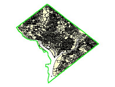
• Thursday, May 9 • Thursday, June 6 The sessions start at 9:00 a.m. and end at 3:00 p.m. Class content is updated as new Census 2000 data are released. Right now it covers the SF1 and SF2 data, and pre-release aspects of SF3. By mid-2003 it will include SF3 detailed housing and race demographics. (See the Census 2000 Products Release Schedule). Registration. Register online via the registration Webform. The fee for the class is $300. The classroom capacity is 10 students. Register early to be assured of a spot! Registration Bonus. Registrants will receive a userid to access/download Washington, DC MSA shapefiles for their own use. These files will be used in the course. The files include a county by census block shapefile for DC, each Virginia county/county equivalent area, and each Maryland county. Also included are the DC, Virginia county/county equivalent, and Maryland county shapefiles. These files may used for mapping applications such as those shown on the sampler page. Agenda 1. Introduction and application perspectives • Overview and changes since 1990 Census • Using the Census 2000 Data Access and Use website 2. GIS Application • Using the Washington, DC MSA GIS Application - computer hands-on application 3. Demographic Data from Census 2000 • Role, scope and importance of Census 2000 and demographic data • Demographic products and schedule • Tabular data reports (new Demographic Profiles) • Summary Files (SF1, SF2, SF3) • Myriad of custom files • Demographic data using American FactFinder -- online access to data 4. Geographic Data from Census 2000 • Geographic products and schedule • Maps in various media • TIGER/Line files (coverage of new Urbanized Area TIGER/Line Files) • Deriving and Derived geographic data resources: shapefiles • Equivalency and geocode cross reference files • Maps and mapping using American FactFinder -- online access to maps 5. Data Integration for Analysis • Integrating Census 2000 geographic and demographic data - Adding demographic fields to shapefile dbf • Integrating non-Census data • Putting Census 2000 demographics on maps • Important thematic maps related to planning 6. Advanced topics in using Census data • Using Census data and physical (planimetric) data • Using other databases, GIS, and the web • Adding data to MS Access and using ArcView 3.x and ArcGIS Instructors. Instructors for the sessions are Dennis Crow and Warren Glimpse. Crow is a GIS specialist with many year experience in working with HUD and has been involved with innovative programs focused on integrating Census data with other types of data resources. Glimpse, founder of Proximity, established the State Data Center Program while with the Census Bureau and developed the Columbia, MO GBF/DIME used as prototype for the Census TIGER System. Glimpse maintains the Census 2000 Data Access and Use Website at http://proximityone.com/cen2000.htm. Training Location and Facility. The classes are conducted at NCPC: 401 Ninth Street, NW, North Lobby, Suite 500 Washington, D.C. 20576 Phone: (202) 482-7200; Fax: (202) 482-7272 NCPC's office is on the fifth floor of the Market Square North Building (entrance on 9th Street). NCPC is easily accessible by Metrorail (take Green or Yellow line to Archives/Navy Memorial or the Red line to Gallery Place). Paid Parking is available in 801 Pennsylvania Ave through the D Street entrance. The training room is set up with ten computers set up in two rows plus an instructor's PC with an LCD projector, ideal for "hands-on" learning, intermingled with seminar-style instruction. Each PC is loaded with modern GIS software and web access at network speeds, plus a local B/W printer for classroom exercises. Additional Information. If you have questions, please send a message using the registration form including your question in the message/text box. |
|