|
|
|
Coos County, Oregon -- Schools, Schools Districts, Neighborhoods & Community GeoDemographics
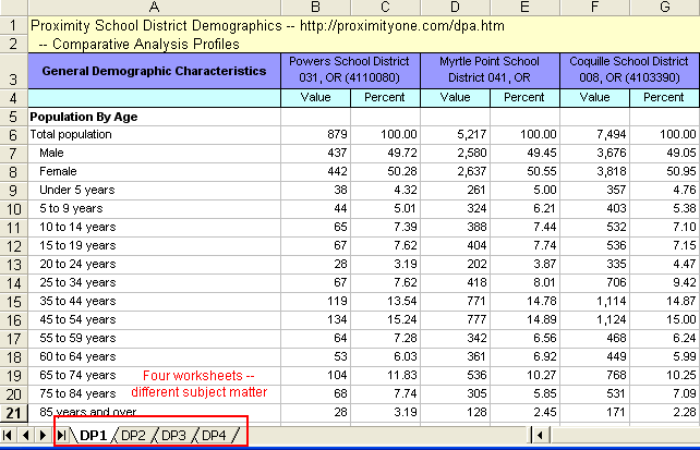
Enhanced versions of CommunityViewer can produce demographic comparative analyses. Click on the image at the right for an example comparing three Oregon school districts. Click here to view these data as an Excel spreadsheet generated by the software (details about spreadsheet content). 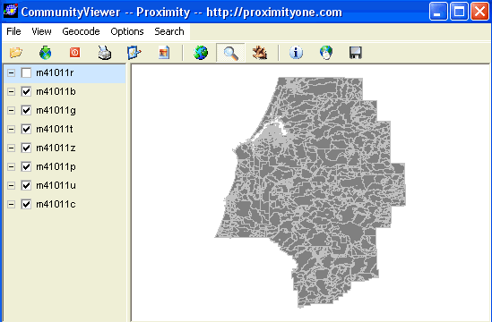
Above View: Seven Proximity-sourced layers (shapefiles) for state 41 (Oregon) and county 011 (Coos): roads (r), blocks (b), block groups (g), tracts (t), ZIPs (z), places (p), unified school districts (u), and county outline (c), 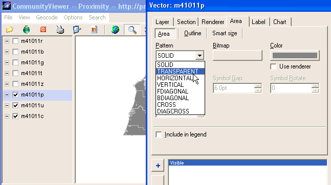
Above View: Changing attributes of the places layer. Pattern is changed from Solid to Transparent. 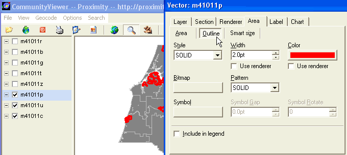
Above View: Changing attributes of the places layer. Outline is changed from gray to red. 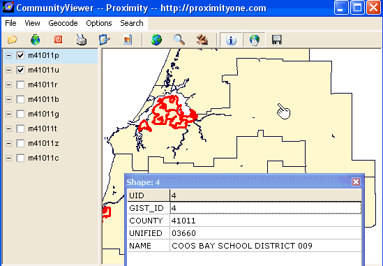 Above View: Unified school districts layer fill pattern color has been changed to beige.
Places can now been seem in context of districts.
The i (identify) tool is used to show attributes of a selected polygon (school district).
No subject matter data about the district have been loaded so only basic geographic characteristics
are available. The identify selection tool has been used to "profile" Coos Bay School District.
Above View: Unified school districts layer fill pattern color has been changed to beige.
Places can now been seem in context of districts.
The i (identify) tool is used to show attributes of a selected polygon (school district).
No subject matter data about the district have been loaded so only basic geographic characteristics
are available. The identify selection tool has been used to "profile" Coos Bay School District.
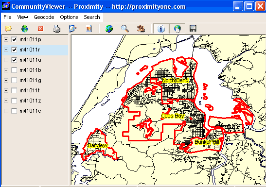
Above View: Using the zoom tool, a zoom-in view of the northwest section of Coos Bay School District is selected. Note that the roads/streets layer is checked on and is placed "above" the school district layer, enabling road features to be visible. 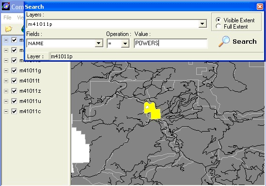
Above View: The Search tool is used to locate place (in shapefile m41011p.shp) of Powers, OR. This view is "out of sequence context" from the previous view. Note the order of layers is different and that all are checked on. The Powers polygon area is highlighted with yellow (the default highlighting color). Note that the exact spelling, in case sensitive mode, is required for string/character field values. The standard and professional versions include more search tool features. The search instruction says "show the polygon in the m41011 layer that contains the value "POWERS" in the field "NAME". 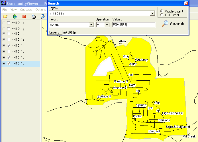
Above View: The zoom tool is used to zoom-in to the Powers location. Three layers are turned on. They are displayed in the map from "top to bottom" as streets, places, and then school districts. 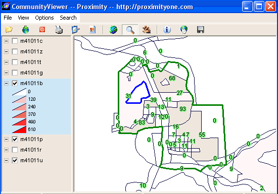
Above View: County by block thematic map showing total population. Zoom into the Powers area shows total population by census block. 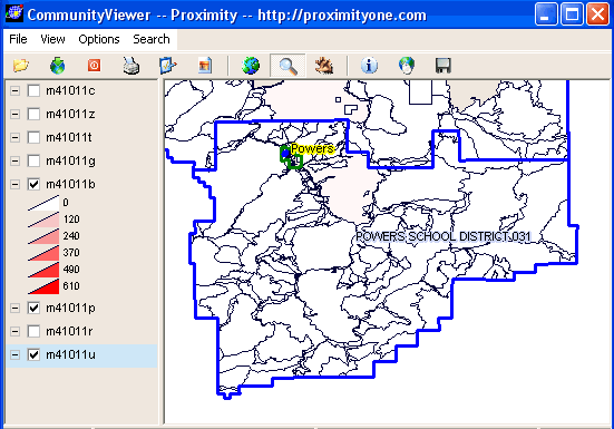
Above View: A zoom-out to Powers school district showing Powers city in context of Powers school district. County by census block total population map still on, the uncolored block areas have zero/near zero population. 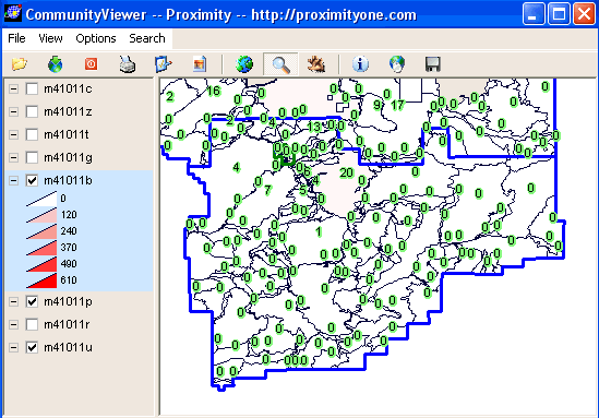
Above View: Same view as above labeling each census block with total population. 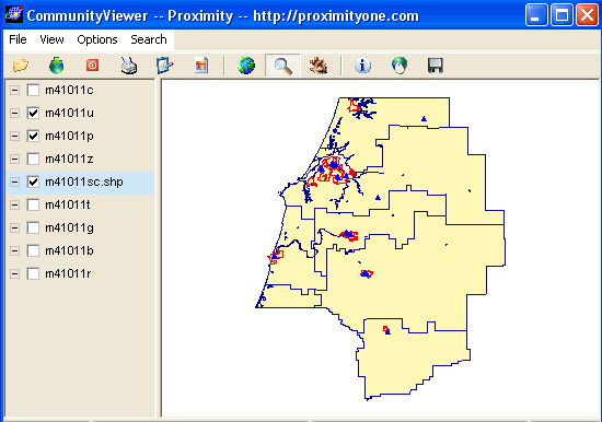
Above View: County by school district showing schools. 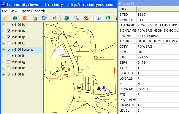
Above View: Zoom into Powers showing locations of 2 Powers schools and profile of high school (profile has extended attributes not shown). 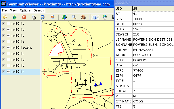
Above View: Zoom into Powers showing locations of 2 Powers schools and profile of elementary school (profile has extended attributes not shown). [goto top] |
|
|